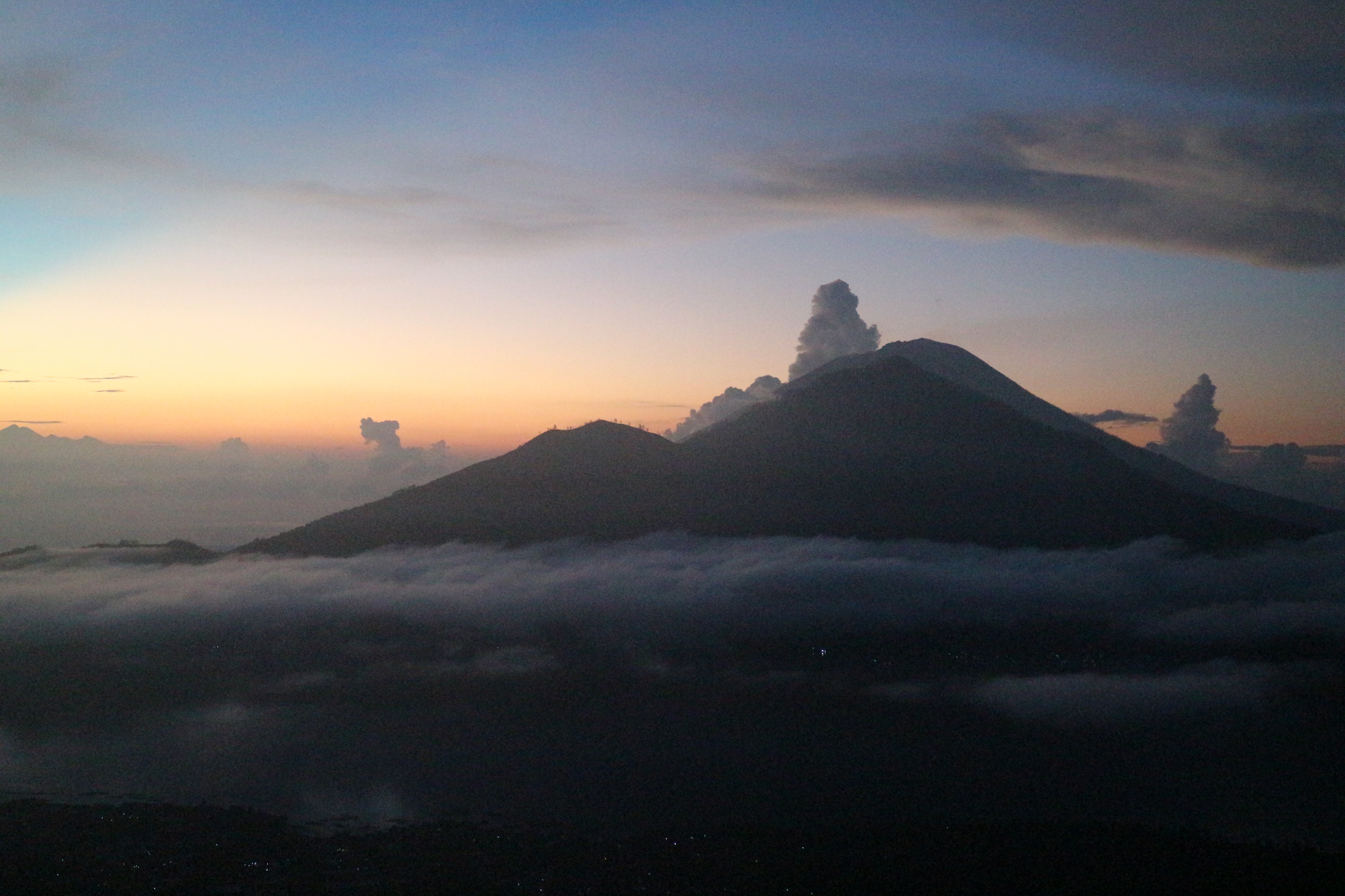
Two of them are Mount Batur and Mount Agung which have features for the people of Bali. Both of these mountains are considered as a phallus or natural phallus which has important significance in the religious life of the Balinese people.
Mount Agung is considered to be the embodiment of Purusha (male) and Mount Batur is considered as a form of Pradhana (female).
Between Purusha and Pradhana cannot be separated because they always work together to create fertility and create prosperity for the community.
the two mountains have a tight bond that is Mount Agung appeared in the “lap” of Mount Batur after erupting thousands of years ago.
“When Mount Agung erupted in February 1963, Mount Batur also experienced an increase in activity in September of the same year. Mount Agung and Mount Batur were on one plate line.

Since prehistoric times, people have believed that mountains, hills and higher places are sacred places as ancestral spirits’ homes and other centers of natural strength.
This can be seen from the direction facing the sarcophagus or corpse without a container. The direction towards or location of the corpse heads mostly leads to the nearest hill or mountain.

This was confirmed by Kadek Arya, one of the residents who lives near Lake Batur. To Kompas.com, a man who works as an onion farmer on the slopes of Mount Batur admitted that the land around Mount Batur is very fertile.
“Anything planted around here definitely grows well including onions. This is also because of the ashes of the eruption of the old Batur mountain,” he explained.
According to him, even though the status of Mount Agung rose to be alert, conditions on Mount Batur were still fine.
Mount Batur is located in Kintamani, Bangli, Bali and is one of the most visited tourist attractions.
In the Mount Batur region there is also a lake with the same name, Lake Batur which is located in a high area, which is 1,050 meters above sea level with an area of 16 km square with an average depth of 50.8 km.
From the Batur Geopark Museum data explained, if the first eruption of Mount Batur began in 1804. When it formed the main crater at the summit.
17 years later, in 1821, a second eruption took place from the same crater. In 1849 an eruption took place from the main crater and produced a flow of lava southward to the edge of the lake.
Between the period 1994/1995 until 2003, Mount Batur erupted 5 times, namely between 1994 and 1995. Subsequent eruptions occurred in 1997, 1998, 1999, and 2000. Eruptions that occurred in 1998 formed a new crater known as Crater 98.
